BorderTransportationSystem ™ ©
Jobs, Security, Speed, & You
------ Menu -----
|
BorderTransportationSystem ™ © Jobs, Security, Speed, & You
|
------ Menu ----- |
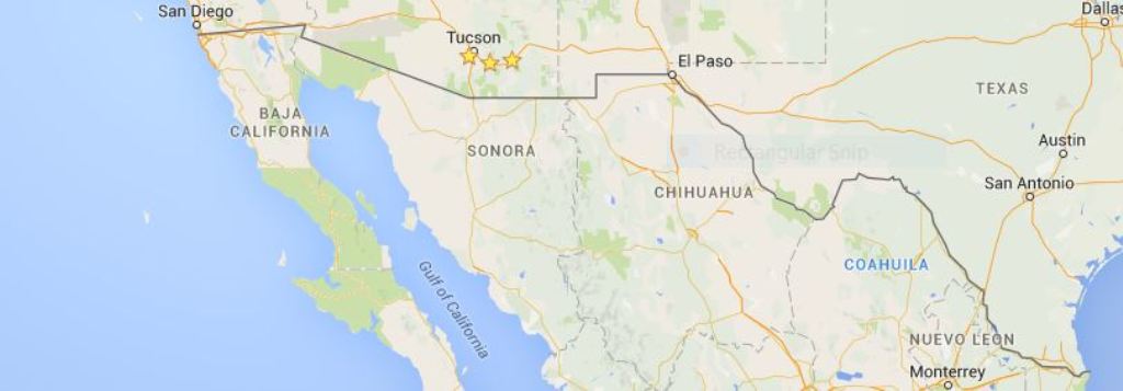
Following Existing Roads and Rivers
Much of the problem in building a 'Great Wall' along our U.S.A. / Mexican Border is that all of the border from El Paso, Texas to Brownsville, Texas is under water, it is in the middle of the Rio Grande River and its lakes and Reservoirs.
The BorderTransportationSystem will have to follow the existing border in California, Arizona, New Mexico and then parallel the Rio Grande, either on the U.S.A. side or the Mexican side, or both. The proposed design is 'both'.. There are towns and roads on both sides of the border and using these as part or all of the route segments will cut cost as these are already 'Public Property' and therefore, paid for. Additionally, much of the grading work is done, and there are known items such as faults, rivers, valleys, hills, mountains, etc. that will make the overall project design easier.
Index of ...
|