BorderTransportationSystem ™ ©
Jobs, Security, Speed, & You
------ Menu -----
|
BorderTransportationSystem ™ © Jobs, Security, Speed, & You
|
------ Menu ----- |
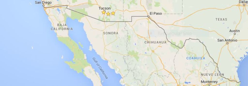
Proposed Routes & Existing Crossings
The following are the towns, roads, and border crossings that should be followed by the BorderTransportationSystem route. Some of the proposed route is best built in Mexico and some in the U.S.A.. Note that many of the towns with crossings have dual crossings, one for the vehicles and pedestrians and another for commercial truck traffic. There may also be a railroad crossing in some locations. Additionally, many of the crossings are in the center of the population areas and therefore, will be difficult to design around without destroying homes and businesses.
Index of ...
Border Friendship Park, Cal
35 Border Crossings plus Otay International Border, Cal
Tecate Port of Entry, Cal
Jacumba Hot Springs, Cal
Calexico / Mexicali, Cal
Los Algodones, Colorado river
San Luis, Route 2 in Mexico
end Route 2, Sonoyta Mexico
Sasabe border crossing
Nogales, Arizona crossing
Naco, Arizona crossing
Douglas, Arizona crossing
Route 2 in Mexico
End Route 2, sharp north turn
Desert, sharp turn east
Puerto Palomas, Mexico
County Route 9 to El Paso
El Paso crossing
Route 375 south
Route 2 in Mexico, El Porvenir
Rio Grande River, winding
Big Bend National Park
Langtry, US-90
Del Rio US-377
Del Rio US-277
Piedras Negras crossing
El Indio Highway Route 1021
Eagle Pass Road Route 1021
Mines Road Route 1472
Hidalgo Mexico crossing
Laredo, Texas
US-83
Nueva Ciudad Guerrero
Ciudad Miguel Aleman
McAllen / Reynosa
US-281 at Alamo in Pharr
Brownsville / Matamoros
Brownsville Port Isabel Highway
|